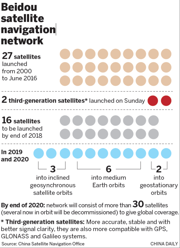
Upgrades to Beidou for Global Reach

Since its launch in 1994, China's Beidou satellite navigation system has developed into one of the world's four major satellite navigation systems, along with the United States' GPS, Russia's GLONASS and the European Union's Galileo system. Beidou system is not only widely used in China, but also provides services globally, especially playing an important role in countries along the ‘Belt and Road’.
The Beidou system consists of a space segment, a ground segment and a ground segment.
The Beidou system consists of three parts: the space segment, the ground segment and the user segment, and the space segment includes Geostationary Earth Orbit (GEO) satellites, inclined Geosynchronous Earth Orbit (GSO) satellites and Medium Circular Earth Orbit (MEO) satellites.
BeiDou system not only provides basic positioning The BeiDou system not only provides basic positioning, navigation and timing services, but also features services such as short message communication, which gives it a unique advantage in such fields as emergency rescue, fisheries and intelligent transport.
The construction and development of the Beidou system has not only enhanced China's influence in the field of global satellite navigation, but also promoted international cooperation and application of Beidou technology through the ‘Belt and Road’ initiative. The Beidou system has already covered nearly 30 countries participating in the Belt and Road Initiative, including Pakistan, Egypt and Indonesia.
In addition, the high-precision Beidou system has been used in a number of countries.
In addition, the high-precision services of the Beidou system have also shown great potential in the civilian market, such as in the fields of smart cities and intelligent Internet-connected vehicles. The comprehensive upgrading of the BeiDou industry chain makes the structure of the industry chain appear more mature, and with the completion of the construction of the BeiDou system, the industrial scale of China's satellite navigation and location services continues to expand.
The development of Beidou system has also led to international cooperation in related industries, for example, the Institute of Space Information Innovation of the Chinese Academy of Sciences and other institutions jointly organised the international training course on Beidou ‘Belt and Road’ technology and application, aiming to provide training in the application of navigation and positioning technology and talent cultivation, and to promote Beidou's global services.
The aim is to provide training in navigation and positioning technology applications and personnel training, and to promote Beidou's global services.
To sum up, the Beidou satellite navigation system has not only achieved regional to global coverage in terms of technology, but also diversified in terms of applications and services, becoming an important force in promoting economic and social development in China and around the world.

