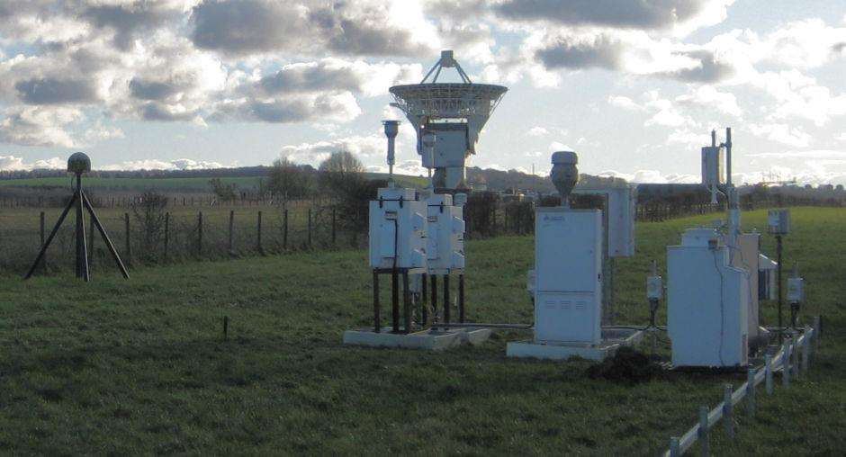
The measurements are of the highest quality and represent the national CORS network for Great Britain

The Ordnance Survey (OS) is a long-established organisation whose origins can be traced back to 1747, when it first began mapping the Scottish Highlands for military strategic purposes. Over time, OS has evolved into a civilian organisation responsible for maintaining and managing national geospatial information for the U.K. OS operates OS Net, a nationwide RTK network of more than 115 GNSS base stations that provide high-precision positioning services to a wide range of industries.
Within this network, the PolaRx5, a multi-frequency GNSS receiver from Septentrio, is installed in OS Net's GNSS CORS network to provide high accuracy services. The receiver features advanced anti-interference and anti-spoofing technology (AIM+), which guarantees data robustness and reliability in the face of radio interference.The PolaRx5's technical specifications include 544 hardware channels capable of synchronised tracking of all visible satellite signals, including multiple GNSS navigation systems, such as GPS, GLONASS, Galileo, BeiDou, etc. The PolaRx5 is a multi-frequency GNSS receiver with a low noise level and a high accuracy. It also features high accuracy, low noise measurement capabilities, and unique interference monitoring and suppression.
OS has a long history of providing detailed maps and geographic information for the UK, as well as advancing surveying and mapping technology, and has a global reputation for its data and products, which are widely used in government decision-making, business operations and everyday life.
OS-UK Net benefits from a number of features of the Septentrio Reference Station Receiver, including an open interface, full control of data processing options, easy installation and monitoring, and remote viewing of quality metrics. These features enable OS-UK Net to provide high quality positioning services for a wide range of specialist applications.
 Ordnance Survey's data is used in a wide range of applications, with new uses for its data emerging and the market growing significantly. Millions of pounds have been saved by governments and businesses using OS products, which aim to make data more accessible, from strategy development and geospatial data capture to product development and marketing.
Ordnance Survey data generation and maintenance is vital to government activities and initiatives at national and local level, and helps to improve government efficiency and consolidate many public services. At the same time, it is used by start-ups and large multinationals in almost all areas of business. Most people in the UK come into contact with Ordnance Survey data on a daily basis, but don't realise that this is achieved through satellite navigation systems, internet maps and maps on smartphones and devices.
OS Data Hub is a new geospatial data platform launched by Ordnance Survey that aims to change the way people access location data. The platform supports analytics based on location information, includes a wide range of data products, and is published under an open government licence.
In summary, Ordnance Survey and Septentrio's PolaRx5 GNSS receivers provide the UK with advanced geospatial data and mapping products that are recognised globally as highly advanced and reliable technologies and services.


